Description
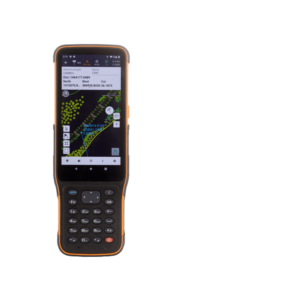
The LT60H is a rugged GNSS RTK smartphone, a reliable and effective tool for various industries and applications that require centimeter or decimeter positioning accuracy. Its portability, durability, and versatility make it an excellent choice for precision GIS data collection, urban construction, utility inspection, agriculture, and more.
With its 6.3″ sunlight-viewable display, the LT60H is an optimal data controller for field professionals who need to position or locate assets and capture associated photos or video. Unlike consumer smartphones, the LT60H has an industrial IP67 design that can withstand daily use in harsh environments and conditions.
Customized low-level system processing allows almost any third-party Android-based mapping application to obtain highly accurate location information directly, significantly reducing software development efforts.
DOWNLOAD DATA SHEET