Description
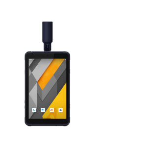
The LT800 is a rugged AndroidTM tablet designed to increase the mobile workforce’s efficiency and productivity in applications requiring meter-level GNSS positioning and uninterrupted performance. Portable, rugged and versatile, it enables GIS data collection, environmental surveys, landscaping, and other scenarios.
Its 8.1″ sunlight-readable display makes it easy to view GIS data tables, complex vector and raster maps, and high-resolution images clearly, even in direct sunlight and brightly lit areas. Its IP67-rated industrial design enables it to withstand daily use in harsh environments and conditions, making it a preferred choice for field crews with demanding requirements.
DOWNLOAD DATA SHEET