Description
HIGH RESOLUTION 360° IMAGES
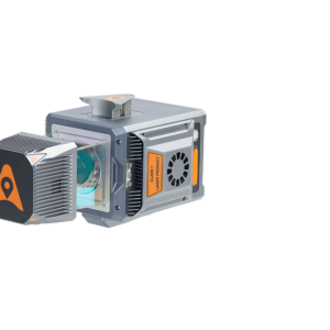
30 MP HDR panoramic camera with superb image quality
Support fully calibrated point clouds and panorama images. You can add additional imagery sensors to get extra information whenever your application needs.
READY NOW TO ANTICIPATE FUTURE
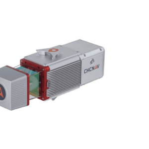
Ready to add 2nd scanner for more density point clouds
Provide two RS232 ports for external device connection, 2nd GNSS antenna to work on railway or water applications, and an easy-in easy-out SSD hard disc for faster data transfer.
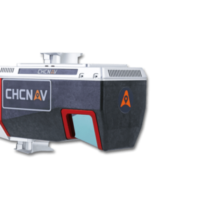
VEHICLE INDEPENDENT PLATFORM
Easily mounted on different type of vehicles, trains, railway trolleys and boats
Whatever the task is, the Alpha3D rapidly and efficiently collects high density, accurate point clouds and powerful images data, but also adds extra information from additional sensors, such as high-resolution camera, thermal camera, GPR, echo-sounder or extra profiler.
CHC Navigation offers to geospatial professionals a premium high-performance, vehicle-independent mobile mapping solution to capture 3D mass data in continuously changing world environments. Whatever the application, the Alpha3D mobile mapping system significantly increase your return-on-investment by completing work quicker and more accurately.
The Alpha3D combines state-of-the-art high-performance hardware, such as long range, ultra-high speed, precise laser scanner, high-resolution HDR panoramic camera in combination with advanced GNSS receiver and high precision IMU, in one instrument with lightweight and compact but in same time rugged design. All these features keep Alpha3D as one of most innovative mobile mapping system in the market today.
DOWNLOAD DATA SHEET