Description
THREE-DIRECTION SCANNING SYSTEM
Laser mirror alternates between strict nadir and ±10 degrees forward and backward
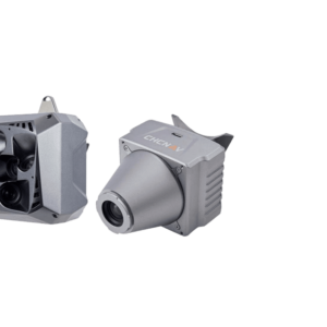
The AA1400 enables data acquisition with unrivaled completeness, especially in challenging environments with vertical surfaces and narrow canyons. In addition, it significantly reduces field operation time by minimizing laser shadowing and provides geometry on complex vertical structures in a single pass. In addition, the ability to integrate external cameras – DSLR, thermal or multispectral, empowers an unlimited number of applications.
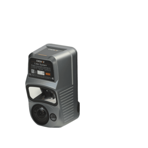
The AlphaAir 1400 is a lightweight airborne laser scanner featuring an impressive weight, range, accuracy, and pulse rate combination. The AA1400 belongs to the Alpha LiDAR series. It is known for its high accuracy and data quality without compromising reliability and is specifically designed for use on various UAV platforms, helicopters, or small airplanes at up to 720 m operating flight altitude.
The AA1400 system integrates a Riegl’s VUX-120 with a unique forward and backward-looking field of view (FOV) designed to minimize laser shadowing and provide geometry on complex vertical structures in a single pass. In addition, the VUX-120 airborne laser scanner features a wide 100-degree field of view, a high-speed data acquisition rate of up to 1.8 MHz, and a scanning range of up to 1430 meters.
The industrial-grade CHCNAV’s GNSS and high-precision IMU allow the AlphaAir 1400 to provide up to 1 cm accuracy, depending on the scanning range.
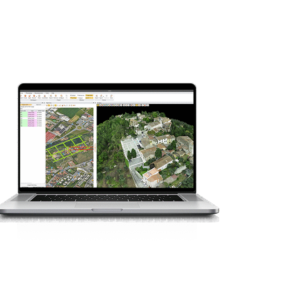
DOWNLOAD DATA SHEET