Description
STRONG VEGETATION PENETRATION
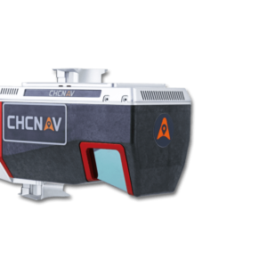
The AU20’s advanced multi-target capability supports up to 16 target returns, enhancing its ability to penetrate vegetation. Capturing ground surfaces and generating accurate Digital Elevation Models (DEMs) and Digital Surface Models (DSMs) is effortless, even in challenging environments with dense vegetation. Installing the AU20 on aerial survey drones is fast and easy, thanks to Alpha port’s one-click connection to the power source and camera.
LIGHTWEIGHT MULTI-PLATFORM DESIGN
The AU20 LiDAR is light and compact, weighing just 2.82 kg. Combined with its car mount kit, including a Ladybug5+ and SLAM technology, the total weight is only 10.7kg. With its flexible multi-platform design, the AU20 can be easily mounted on manned and unmanned aircraft for airborne scanning. In addition, it can be seamlessly integrated into a variety of land vehicles, such as cars, boats, and trains, for mobile mapping applications. The AU20 can also be mounted on a backpack for narrow-area mapping providing unparalleled versatility.
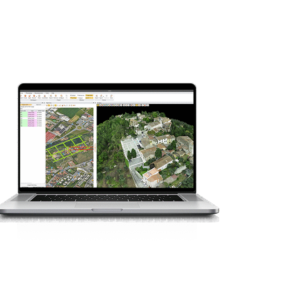
The AlphaUni 20 (or AU20) is a cost-effective, multi-platform mobile mapping system of premium class. As a result of six years of innovation and product development, it harnesses the power of CHCNAV’s state-of-the-art LiDAR technology. The AU20 excels in airborne scenarios, delivering superior data and increasing survey efficiency through its exceptional vegetation penetration capability, extended measurement range, high accuracy, and data density.
With its unique and flexible installation design complemented by CHCNAV’s LiDAR technology, the AU20 achieves the perfect balance of point cloud density, accuracy, and quality. The system enables precise point cloud and immersive panoramic imagery tailored for various applications, including road surfaces, highway maintenance, and asset management through vehicle-based surveying.
The AU20 is redefining mobile mapping, democratizing the reality capture industry, and making it accessible to all geospatial professionals.
DOWNLOAD DATA SHEET