Description
High Data Quality
Integrated premium scanners
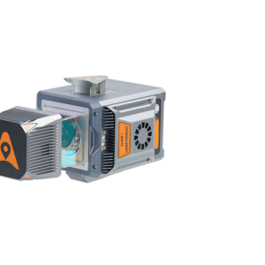
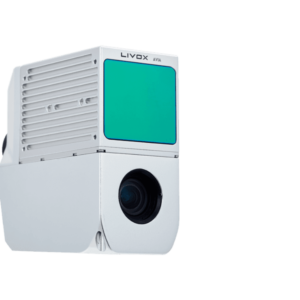
Users can select either the miniVUX series AU300 or the self-designed CHCNAV AU20 for higher data density. Equipped with industry-leading GNSS and IMU sensors, the AlphaUni 20 & 300 provide the best combination of point cloud density, precision, and survey-grade accuracy.
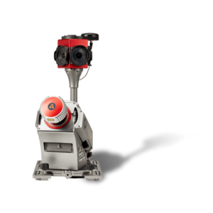
AlphaUni 300, belonging to our Alpha Mobile Mapping series, is a multi-platform LiDAR system that has been designed and improved by CHCNAV based on many years of research and data capture experience. AlphaUni 300 is a fully integrated system with a high-precision laser scanner featuring Riegl’s unique Waveform-LiDAR technology and a high-accuracy inertial navigation system, ready for demanding surveying missions in the air and on the ground, requiring the highest data quality.
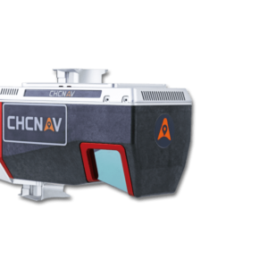
AlphaUni 20 is a new generation of cost-effective multiplatform mobile mapping systems built based on fully CHCNAV state-of-the-art LiDAR technology. The unique in-the-market flexible installation design with the best combination of point cloud density, precision, and survey-grade accuracy by CHCNAV LiDAR technology can provide accurate point cloud and immersive panoramic imagery for applications such as road surfaces, highway maintenance, or asset management by vehicle survey.