Description
Greatest Flexibility
Support multiple platforms installation
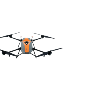
In only 5 minutes set-up time the AlphaUni 900 allows users to capture reality from multiple platforms, including different UAV models, multi-rotor and fixed-wing VTOL UAS, and then switch to vehicle mode for highway measurements and high-precision maps with our advanced kit with panoramic camera or quickly switch to backpack mode when the UAV and vehicle are unable to complete the mission.
3D POINT CLOUD PROCESSING SOFTWARE
Powerful and accurate 3D point cloud generation
CoPre is an advanced, user-friendly 3D laser scanning pre-processing software that can process captured raw data, including POS trajectories, LiDAR data, and RGB images. CoProcess is a reality capture post-processing software providing DEM/DTM generation, semi-automated feature extraction, automatic data classification, and dedicated power line and road inspection modules. With its intuitive interface and efficient workflow, the software significantly improves the productivity of 3D mapping projects.
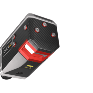
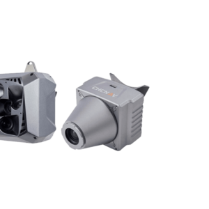
AlphaUni 900/1300 belongs to the Alpha Mobile Mapping family, which are high-end multi-platform LiDAR systems designed and improved by CHCNAV through many years of exploration and data capture experience.
AlphaUni 900/1300 offers a fully integrated system with high-precision, long-range laser scanners with unique Waveform-LiDAR technology from Riegl and a high-accuracy inertial navigation system, ready for demanding surveying missions in the air and on the ground, requiring the highest quality of data.
DOWNLOAD DATA SHEET