WHICH CHCNAV ANDROID DEVICES ARE BEST FOR FIELD DATA COLLECTION AND MANAGEMENT?
CHC Navigation offers a wide range of rugged and durable GNSS field data controllers, tablets, and smartphones designed to meet the specific needs of professionals in surveying, engineering, geodesy, construction, urban planning, forestry, agriculture, and other specialized fields. These devices enable efficient and accurate data collection, management, and analysis in challenging field conditions.
WHY CHOOSE A PROFESSIONAL GNSS OR HIGH-ACCURACY GNSS RTK ANDROID DEVICE FOR FIELD DATA COLLECTION AND MANAGEMENT?
Achieving superior accuracy and durability in field data collection is a crucial benefit of using professional-grade GNSS and high-accuracy GNSS RTK smartphones and tablets. CHCNAV’s professional GNSS data collectors offer two levels of accuracy: centimeter-level accuracy with Real-Time Kinematic (RTK) technology and meter-to-sub-meter-level accuracy without RTK corrections.
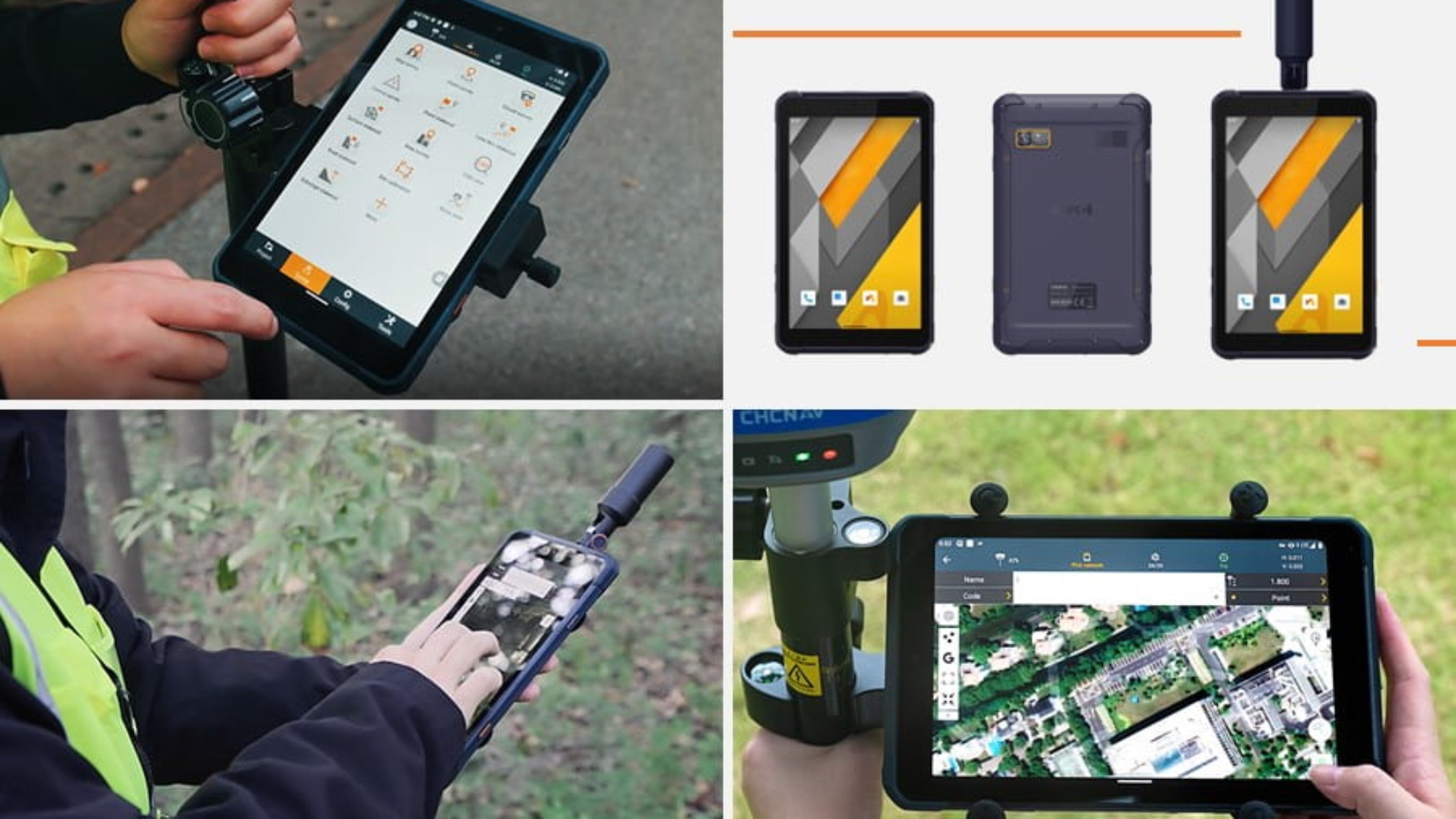
Both the latest generation GNSS tablets (LT800H, LT800) and smartphones (LT60H) share common features, including Google Mobile Service (GMS), Android Enterprise Recommended (AER) certifications, ensuring seamless compatibility with popular data collection applications available on the Google Play Store. These handheld devices feature large, sunlight-readable displays and a rugged IP67-rated industrial design, making them ideal for outdoor use in harsh environments. All of this makes CHCNAV smartphones and tablets the preferred choice for professionals from various industries with demanding needs.
WHAT ARE THE TOP 5 APPLICATIONS FOR PROFESSIONAL HIGH-ACCURACY GNSS RTK ANDROID TABLETS AND SMARTPHONES?
CHCNAV’s LT60H GNSS RTK Smartphone and LT800H GNSS RTK Tablet demonstrate versatility and excellence in a variety of domains, including
- Surveying: Facilitates precise positioning and data collection in producing topographic maps, land surveys, and construction layouts. Surveyors can accurately capture the coordinates of specific points, lines, and areas.
- GIS data collection: Captures accurate location information for GIS databases that support urban planning, natural resource management, and asset inventory applications. This data can be seamlessly integrated into GIS software to create detailed maps, analyze spatial patterns, and support decision-making.
- Utilities & Infrastructure Management: Accurately locates and maps underground utilities, pipelines, and infrastructure assets. Facilitates precise identification and documentation of surface and underground infrastructure locations, ensuring accurate placement of infrastructure components.
- Construction: Enables precision surveying, structural monitoring, asset management, and construction planning. Construction professionals can accurately measure and map construction sites, monitor progress, and ensure structures are built according to design specifications.
- Agriculture: Empowers field mapping, yield monitoring, and input optimization in precision agriculture. Provides precise location information for soil sampling, crop scouting, irrigation, fertilization, and planting; helps farmers maximize yields, optimize input use, and monitor field conditions and crop health. CHCNAV Android mobile devices support a wide range of precision agriculture software solutions from multiple vendors, enhancing their value for the farming community.